A reserve doesn’t run on mains power, and it doesn’t get coverage in the gullies.
Trail cameras fill SD cards nobody has time to collect. The water point on the far boundary gets checked when someone happens to drive past. The weather station is whatever the nearest town reports, not what’s happening on the ridge. And everything that is being watched lives in a different app, on one person’s phone.
You need the whole park on one screen — cameras, water, weather, fire — with no telco in the field and no monthly bill.
That’s OGLAS Park.
Trail cameras without the card swaps
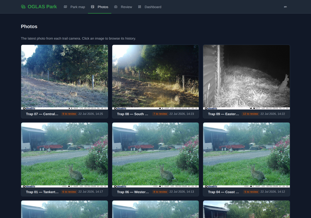
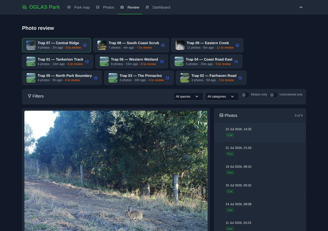
Photos come home over long-range radio and land in a review queue — no driving out, no SD cards, no mobile plan per camera.
Work through the queue camera by camera: tag the species, mark the sighting, sign it off. Filters for motion-only and unreviewed keep a big week manageable.
The fox at 2am is on your screen by breakfast, not on a card in the bush.
One shared map of the park
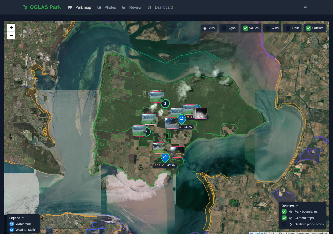
A satellite map of your reserve with every camera, water point and weather station on it — plus park boundaries and the bushfire-prone overlays that matter in a Victorian summer.
Live values sit right on the map: trough levels, temperature, wind. Share it read-only with volunteers, committee and neighbouring land managers — they see the park, not the controls.
The morning check, on one screen
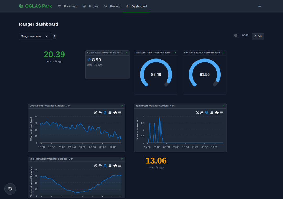
The Ranger dashboard pulls the whole reserve together: what the cameras saw overnight, which tanks moved, wind and rain across every station.
It’s built from the same widgets as every OGLAS dashboard — rearrange it, add a camera, drop on another gauge. No subscriptions. No telco. Your data is your data.
Here’s what that looks like on a real reserve
Nine trail cameras across the tracks and boundaries. Water tanks at the north and west ends, reporting level by radio. Weather stations at the coast road, the pinnacles and the wetland. All of it solar powered, all of it off-grid, all of it on one satellite map with the fire overlays turned on.
The ranger opens one dashboard in the morning. The committee gets a read-only link. The photos are reviewed by whoever has the time this week, from home. Nothing to collect, nothing to subscribe to, nothing leaves your hands.
Want to see this for your park?
Friends-of groups, committees of management, councils, private conservancies — if you look after land and the things on it, we build the system that watches it with you.
Or reach us directly: scottp@dd.com.au
—
Built by Scott Penrose at Rainbow House / Digital Dimensions.